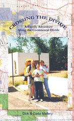
The Amazon Outdoor Store
If you plan to hike the Great Divide Trail the first thing you want to do is go out and buy Dustin and Julie Lynx book. It is all I used for route finding and it was well written, accurate and informative. I believe there is a revised edition out or coming out soon. Check with Rocky Mountain Books.
Dustin: I think of the Great Divide Trail quite often. It was my job this summer to share my
knowledge of the Canadian Rocky Mountains with visitors at the Parks Canada Visitor
Center in Lake Louise. Although my experience on the GDT got me the job, I never
answered any questions about the route itself. If people had asked me about the Canadian
Rockies Great Divide Trail, the following is the shortest description that I could have
offered.
Physically, the proportions of the Canadian Rockies Great Divide Trail are dwarflike
compared to other long trails on the continent. In respect to its southern cousin (CDT), the
GDT is over 2000 miles shorter. In total, it only reaches 900 miles from the USA-Canada
border to northern British Columbia, near Prince George. Maintaining an average pace of 15
miles a day, one could hike the route in 2 months. It is hardly an easy hike though.
This summer was the 14th coldest one on record in the Canadian Rockies. On July 5,
Highway 93 between Lake Louise and Jasper closed for most of the day until crews could
clear two feet of snow. With over three feet of accumulation in the high-country, the snow
took nearly a week to melt. This was on top of the existing snow. Many passes on the GDT
held on to their winter snow-pack until the end of August. Due to all the melt water, some of
the backcountry campsites in Banff National Park were inaccessible until the end of summer.
It was cold and hikers suffered. I helped more than one beleaguered hiker reorganize their
long trip into a series of shorter outings. On the bright side, the mosquitoes suffered too.
I mention the climate before my thumbnail sketch of the route because the GDT is as much
the weather and the environment as it is a narrow footpath winding through meadows or
forest. The route itself is a series of established trails that link well to form a long route
which follows the continental divide as close as possible, crossing it nearly three dozen times.
Half of the route follows superb trails through five national parks. The other half is in
provincial parks, wilderness areas, and forestry districts. The majority of the route is in the
province of Alberta but it ends at Kakwa Lake Provincial Park in British Columbia. At the
southern terminus, in Waterton Lakes National Park, the route meets up with the
Continental Divide Trail. Here, at the last moment, one could waver between hiking north or
south depending on whether their supply parcels were already in the mail.
The route that I hiked in 1996 is not the same one in my present manuscript. The supply
points are the same but some sections of the route have shifted. The GDT will continue to
shift and the choice of trails will always allow hikers to customize their journey.
Approximately 11% of the GDT is active road or railway. An alternate route usually
incorporates more road or cross-country travel. Experienced backpackers can eliminate
some of the road walking or decide on a more scenic or direct leg. I look forward to my next
hike of the GDT and I know that I will be able to make of it what I want.
A good portion of the first section of the GDT depends on an excellent trail system through
Waterton Lakes National Park. Over Sage Pass, a little known horse trail straddles the
Divide before descending to the West Castle River Valley. The route continues to the small
mining town of Coleman on Hwy #3 mostly on ATV accessible trails with an exciting crest
walk along Willoughby Ridge, just east of the Divide. The first section has two alternate
routes that stay on the shale-strewn crest of the Divide just south of Sage Pass and another
on Barnaby Ridge to the north.
Relying on another 30 miles of ATV trails outside of Coleman, the GDT traverses one of the
most scarred sections of the Canadian Rockies. It is a long section, 130 miles, which teeters
between the devastation of natural resource extraction and remote and impenetrable
wilderness. Nearly half of this section consists of the original Great Divide Trail constructed
two decades ago. The section has a difficult but worthwhile northern finale through Elk
Lakes Provincial Park.
Leaving the second supply point of Kananaskis Village in Peter Lougheed Provincial Park,
the route soon enters Banff National Park. This lengthy section crosses a few hiking Meccas
such as Mount Assiniboine, Egypt Lakes and the Rockwall Trail. It is the busiest section of
the GDT with excellent trail and designated campsites almost the entire way to the town of
Field.
The fourth section contrasts all the others. It follows the Amiskwi, Blaeberry and Howser
Rivers to The Crossing, a resort on the Icefields Parkway. It is the shortest section at 74
miles and it is the lowest, never going above timberline. Unfortunately, there is a 14-mile
road walk leading into the next section that leaves the Parkway at the Sunset Pass trailhead.
The fifth section takes advantage of some popular trails in Jasper National Park but unlike
the third section, it is not as busy. A real prize of this portion of the GDT is the slice of the
'hiker only' accessible White Goat Wilderness. The renowned Glacier and Skyline Trails
bring the route past the Maligne Lake Resort to Jasper. Getting reservations for campsites
on the Skyline can be discouraging but Parks Canada does allow bookings up to three
months in advance for a slim fee of ten dollars.
If the idea of reserving campsites sounds deplorable, you may like the sixth section the most
- I know it is my favorite. It penetrates the remote corners of Mount Robson Provincial
Park, Jasper National Park, Willmore Wilderness, and Kakwa Lake Provincial Park. After a
13-mile railway walk from Jasper, the route takes 168 miles to get to the northern terminus
at Kakwa Lake. The trail is sometimes thin and overgrown but there is no where else on the
GDT that provides such an immersion into the untrammeled wilderness of the Canadian
Rockies. I had the privilege to see a herd of Mountain Caribou and follow a wolf pack over
two high passes during my through hike in 1996.
The next time I hike the Canadian Rockies Great Divide Trail, I will do things differently. I
will take my time on those cross-country sections and take the weather in stride. Some extra
food for an extra day en route makes sense for when it snows - an extra warm layer sounds
good too. Not starting until mid-July is my plan of action; I will skip the flooding and take
advantage of those brilliant September days when the larches turn golden. Binoculars will
come in handy for safely viewing wildlife or for scanning the route ahead.
I have hiked the GDT for the past four summers now; I even skied some segments in winter.
Each time I return I get my face slapped by the harsh environment no matter how prepared I
am or how much I think I had learned from my last outing. The Canadian Rockies is not a
fair-weather range. For anyone planning their journey on the GDT, no matter how long, I
suggest having an alternate plan and a 'go with the flow' attitude. I caution inexperienced
hikers against initiating a long distance hiking experience on this unpredictable route.
I realize now that the GDT is more than just a selection of long trails that link well and
happen to lie near the Divide. The route is an expression, a changing face, of a
temperamental mountain range. It is a special means of communication that interconnects us
with the vast wilderness of the Canadian Rockies. The narrow trail is as much a communion
for us to travel on the heels of a wolf pack as it is for the wild heart Mistaya, the grizzly bear,
to understand our brief encampments and exotic smells. It is so much more than a path
blazed for human recreation.